pilotgreenland

Weather Situational Awareness
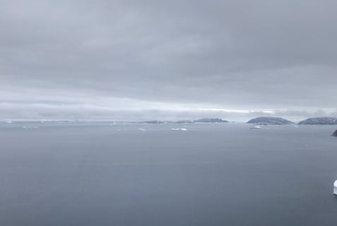
©PamelaGL. Uummannaq District 14 May 2024
This section's introduction post explores how flying in Greenland requires situational awareness of weather - at all times; not only before taking off, but also visualising what could happen with the weather during flight.
When navigating the 44,000 km coastline, pilots build up a unique set of visual cues in their 'mental map'. Exploring ‘visual skills’ through the lens of flying takes into account more than eyesight. It also concerns 'mental mapping' when approaching and taking off in various airports, confined heliports along the coast, or where settlements are located - the quick decision-making.
Flying Weather in Greenland takes good judgment, as well as the pilot skills needed and the 'know-how' in-flight maneuvers to land when conditions are not ideal. In the flying environment of Greenland's uncontrolled airspace, perhaps the 'will' to fly within parameters set by the commercial airliner is also a factor - more to come on Flight Discipline in later posts.
Thinking with the eyes: Single-Pilot Operations and Objectivity
As the flying into weather posts have hinted at, flying in Greenland is not only about ‘weather’. It also concerns the pilot’s situational awareness when navigating the coastline.
The current operation servicing settlements is a single-pilot operation for day and night VFR with H155 (EC155). The operation before was a two-pilot operation only for night VFR, otherwise a single-pilot. The benefit and security when night flying was a set of extra eyes.
Sometimes in a technological world, pilots are seduced by avionics. Technology today has enabled concepts of operating the technically advanced cockpit. There is no doubt, single-pilot operations are admirable and some prefer it over the two-pilot concept and perform well. However, the 4-axis digital auto-pilot does not replace a second pilot, such that technology does require a different mindset to fly. From SIM (Simulator) training, they are trained to programme flight systems and to keep their eyes busy, not fixated too long on one thing.
The technical term is called ‘scanning’. A pilot’s visual sense is not to see everything but to scan. Pilots scan the instruments of the cockpit and scan out in the terrain.
It comes as a suggestion by a highly experienced pilot — single-pilots need to develop personal systems when looking inside which also means looking at the Left Side instruments, close to the ‘next best thing’ when not in a two-pilot crew, not just for redundancy but for knowing when things are not the usual or expected.
A pilot’s eyes are always in constant motion. They are trained to use their eyes in a technical way to measure distances, scale, and calculations. In pre-flight analysis, pilots not only rely on their vision to see, but they also rely on their interpretation of what they perceive. A pilot's skill in scanning is the process of a perceived spectrum of the ‘field’ that begins with the eyes and ends with the processing of information in the brain. What we see is what the brain tells us, and perhaps 'plays tricks' when the brain tries to 'correct' what we see.
One pilot, in the early years before Air Greenland, recalled that back then, there was no iPad, no AirNavPro, and no real aeronautical maps for Greenland. It was difficult to measure distances and scale particularly when the landscape offered no real landmarks to reference, not to mention seasonal changes of the landscape. When going out to fly in a district that was known for fog and cloud cover, this pilot was grateful for the personnel at the local helistop who were able to give the base of the clouds.
When judging the relative distance in space and depth perception, the brain relies on visual cues. For instance, pilots refer to their navigation and flight planning on their iPad to measure distance and vertical height. A visual cue from the ground level, such as a mountain is referenced to gauge the vertical height of a cloud whether above the mountain or below the mountain.
Pilots rely more on their eyesight than any other sense.
Yet, the eyes’ perception is limited in the eye physiology. Eye physiology is a factor affecting vision — more to come on eye physiology. However, the only part of the body that allows us to see is the eyes.
When visualizing weather, do pilots train their eyes to see in a certain ‘way to see’ or ‘visual skill’?
An upstanding and experienced pilot, who flew the AS350 before the H155, made use of taking pictures in 15 to 30-minute intervals of the weather to see the trend. Basically, his method was a way to capture an image as objectively as possible. On a day where the TAF and METAR are questionable, or the development could go either way, taking images is a valuable method. Flying weather is dependent on factors such as temperatures, dew point, wind direction, position of the sun, sea ice, fog and cloud cover, and time of first flight. Throughout the day, the pilot can monitor the trend of the weather. Utilizing resources other than the eyes aids weather situational awareness.
This method of ‘trend watching’, as the pilot noted, requires an analysis without feelings or emotions. When viewing images, the pilot did a step-by-step process. He realized while analyzing the trend, ‘the mind is playing with you’. Such that the mind is saying that the image is better because the pilot wants it to be better. And the opposite occurs when the pilot hesitates to fly, the trend will appear worse.
Having more information when the TAF is not as reliable can make the difference. Throughout the day, the fog did disappear, the day did clear up, and the trend was positive.
The point here is toning down feelings and being objective, plus having a step-by-step method and intelligent use of the camera will assist in the decision-making process.
Part of weather situational awareness has more to do with having less emotions in weather decisions. The preflight analysis of the weather, to Go or No Go, and fuel requirements are best done level-headed. For most pilots, composure is natural. Moreover, it’s better not to take off when the weather is beyond the helicopter’s capacity.
A point to note:
In Greenland, knowing the bottom of clouds is more interesting just in case the route passes a mountain range. It is worth knowing, the closer you get to the cloud base, the worse visibility. A point to note, be careful to stay legal in relation to the VFR rules for visibility and cloud separation. Not least, the cloud base is not without issues. There are mists and vapour that hang down below the cloud. Pilots see the ground but what's ahead is harder to decipher. Descend 100ft and the visibility suddenly improves. If possible, follow the coast. (The next image is climbing out of Upernavik heading for Ilulissat 31 May 2021)