pilotgreenland
Convergence of Winds in Uummannaq Fjord System
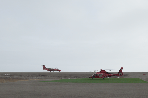
©PamelaGL. Approaching Ukkusissat Helistop 14 May 2024
Convergence of Winds in Uummannaq Fjord system
Lat 70.68, lon -52.112, Heliport, BGUM - UMD Uummannaq
Lat 70.734, lon -52.696, gravel Airport, BGUQ - JQA Qaarsut
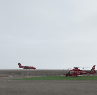
Qaarsut Airport, JQA is where the De Havilland Canada DHC, Dash 8 of Air Greenland lands. Similar to Kulusuk Airport KUS, JQA has a landing strip for aircraft with STOL (short take-off and land) requirements. Similar to Tasiilaq, the hangar sits in Uummannaq, 12 NM East of Qaarsut, JQA. (Image above is of Dash 8 landing in JQA 23 May 2024)
The month of May is known as the 'fifth' season in Greenland bringing unexpected conditions, like snow.
The month of May this far north is 24 hours of sun ----- the sun never sets.
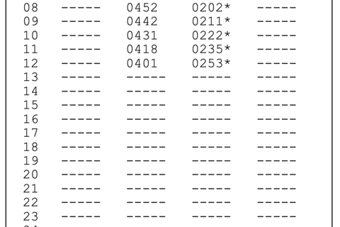
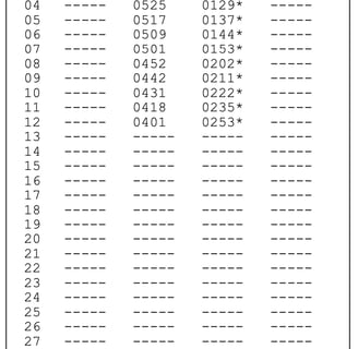
Aviation sunrise/sunset (SR/SS are calculated for the upper edge of the sun at a horizontal refraction of 35' and times apply at mean sea level at the specific location. Below is from the AIP (Aeronautical Info. Publication), Greenland, SR/SS Table with times given for SR and SS for beginning and end of civil twilight, date range of 8 to 23 May 2024).
Then there is the wind direction…..
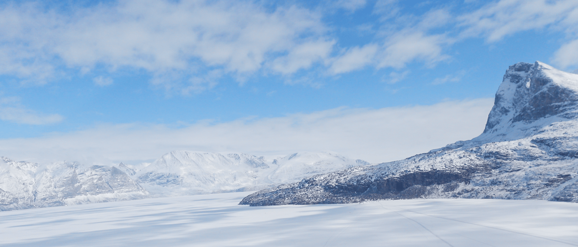
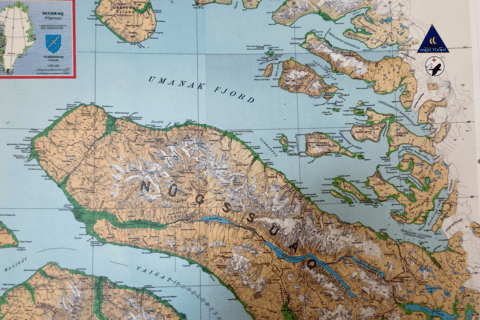
The Uummannaq fjord system has at least five distinct terrain features when thinking about the bigger weather map and the wind direction. The numerous fjords are surrounded by the tall mountain range of Nugssuaq, the inland ice, Svartenhuk north of Ubekendt Ejland, and the open water. (See map above). Knowing what direction the winds blowing over the open water or from the inland ice or bypassing Nuu´gssuaq mountains or through the valley or blowing south from Svatenhuk gives good weather signs and creates a truly fascinating weather picture.
To fly the settlement flights from Uummannaq (hangar location) to settlements Ikerasak, Saatut, Ukkusissat, Niaqornat, and Qaarsut (airport for Dash 8) requires local knowledge of the weather system.
In this northern part of the West Coast, if there is a northerly wind in the fjord, there can be a 360° difference in wind direction. (Image below Uummannaq Fjord system)
He continues:
"IF there is a northerly wind, it comes from out from the ocean. That is not the case in Ukkusissat. The wind there might come from Maamorilik, out that fjord. Even if there is a northerly wind, because Svartenhuk makes it northerly but actually it might not be northerly further north.
When the winds are from the South or South Easterly or South Westerly, the wind changes in all directions.
When the wind comes from the south side of Nugssuaq, it might come from the East in Uummannaq due to the height of the mountain range which is about 7500 ft. Yet if you move towards the inland ice which is about 2500 ft, the wind comes around that corner and feels like it is coming from the East, Southeast. In reality south of Nugssuaq, it comes from the south.”
Winds are what makes the weather map in this fjord system rather interesting, to say the least.
Winds are layered and blow differently depending on the unique features of Greenland’s coastline. It blows differently at various altitudes which means helicopter pilots require quick decisions to be made before the approach and climb.
An important part of wind is the fact that the air converges and there are places where the winds from opposite directions come directly head-on.
The wind may be calm close to the ground, specifically near valleys. Winds can also blow in a different direction a few hundred feet above ground, which can be a hazard during a climb if there is an unexpected sudden tailwind.
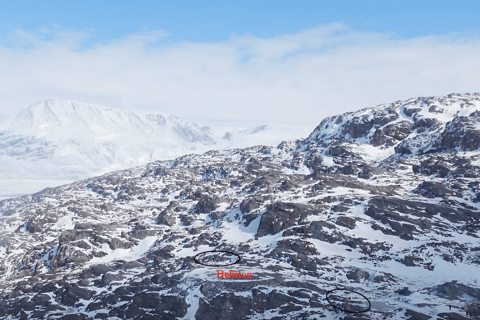

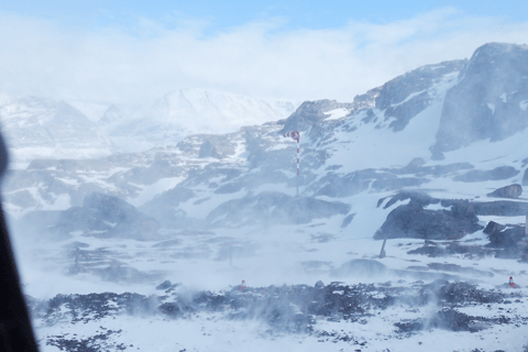
Take for instance the helistop, Ukkusissat.
The image above is the 2 windsocks located on Ukkusissat, opposite ends of the hélistop. The helistop is noted in red text on the circular spot. The 2 windsocks are circled.
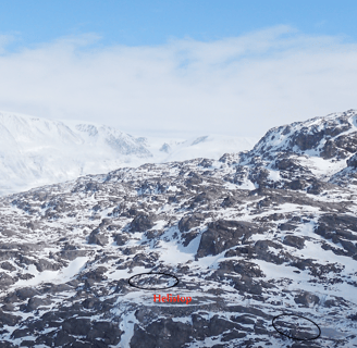
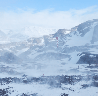
On this helistop, there is possible wind convergence. Convergence can be minimal or can be quite extreme on this island due to the fjords, the shape of the island itself, the mountains in the back, and if the winds are coming from the inland ice. Occasionally, pilots can experience a 180° difference in wind direction between the two windsocks. Below are images of the two windsocks.
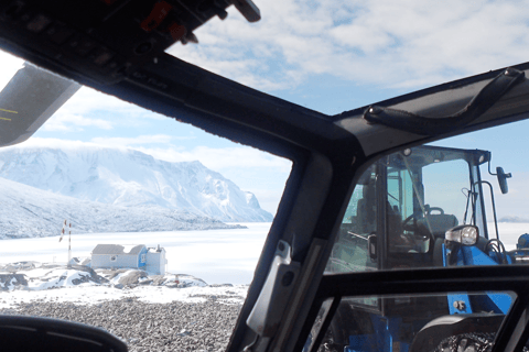
When pilots approach and land in one direction, they might have to climb out in the same direction. During a climb out, pilots face a headwind, yet knowing the wind could change to a tailwind and this could be hazardous.
Pilots must be observant and have to abort the plan -up to the last second.
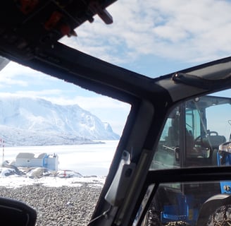
Pilots must be clear of the mountain to gain altitude on a climb just in case of tailwind. (Image below is windsock on approach to Ukkusissat. Second image is the other windsock in teh opposite direction)
Back in the day when there was a route to Nuugaatsiaq, a settlement north of Ukkusissat, according to an ‘old timer,’
“Whatever wind direction there was in the fjord going there, when you got there, a majority of the time, the wind came from the inland ice. And the strong winds make it so difficult. Also in Niaqornat, Nugssuaq mountains make the winds behave differently. If the wind comes from the southeast from the ice sheet in Uummannaq, the wind might come from the southwest in Niaqornat due to the tall Nugssuaq mountains and the valley that comes down west of Niarqornat."
Wind affects flying from the moment of take-off until the landing and the helicopter is secured back into the hangar. Flying in Greenland, the wind indication tells how to think and act when landing close to uneven terrain, how much room there is for take off and land, and how much updraft and downdrafts. Winds also give a bigger weather picture. On a weather map, if the isobars are close together, the wind will be strong and the wider the isobars, the calmer the wind.