pilotgreenland
Before the Strong Winds from the Inland Ice (Pitteraaq)
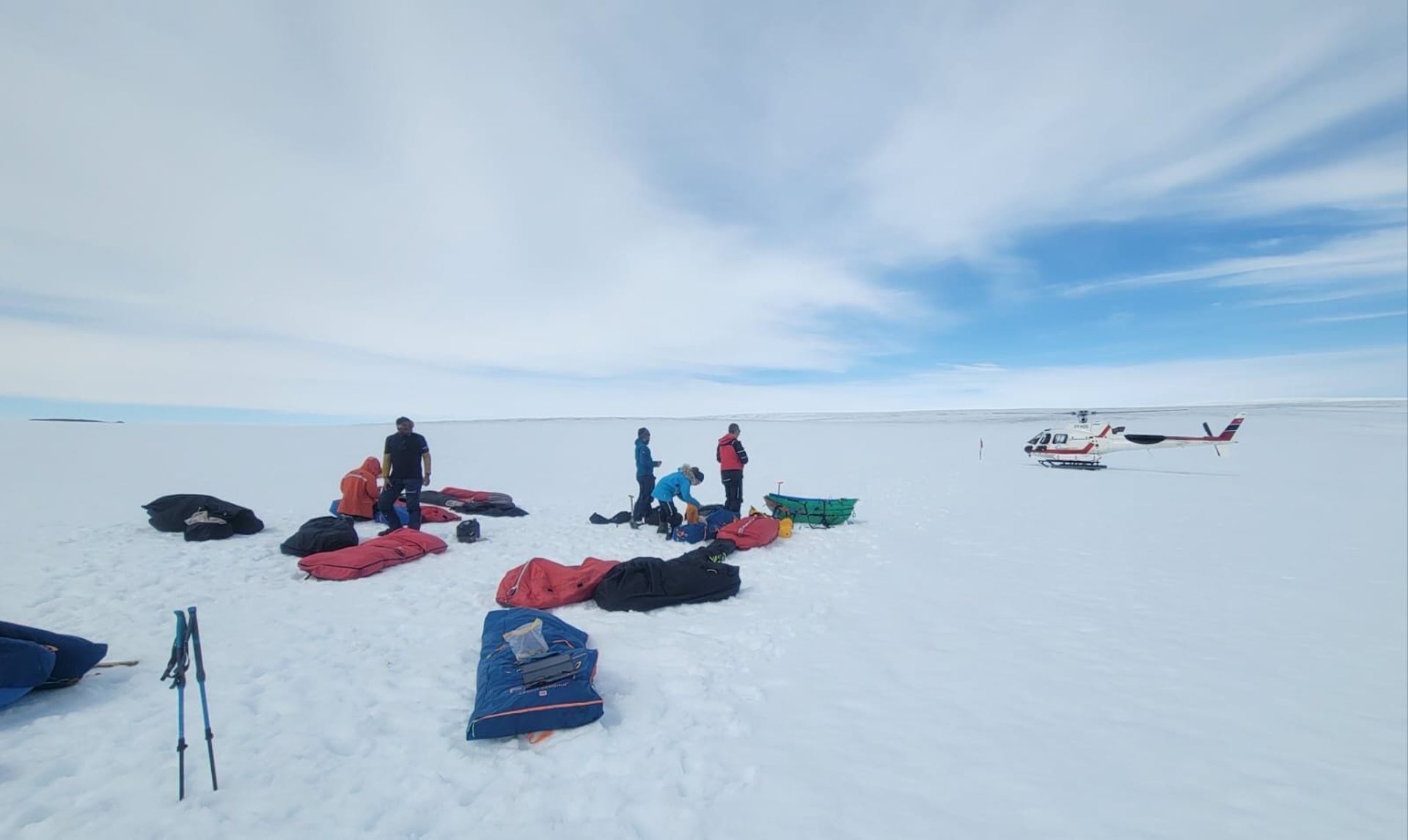
©PamelaGL Greenland Copter picking 1 of the 4 teams at known pickup location as skiers descend down the Inland 1 June 2024 - BEFORE THE STORM HITS
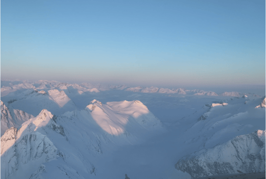
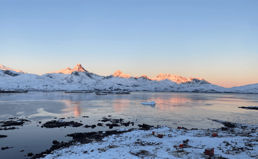
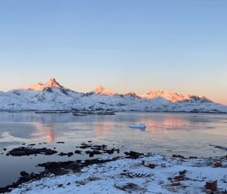
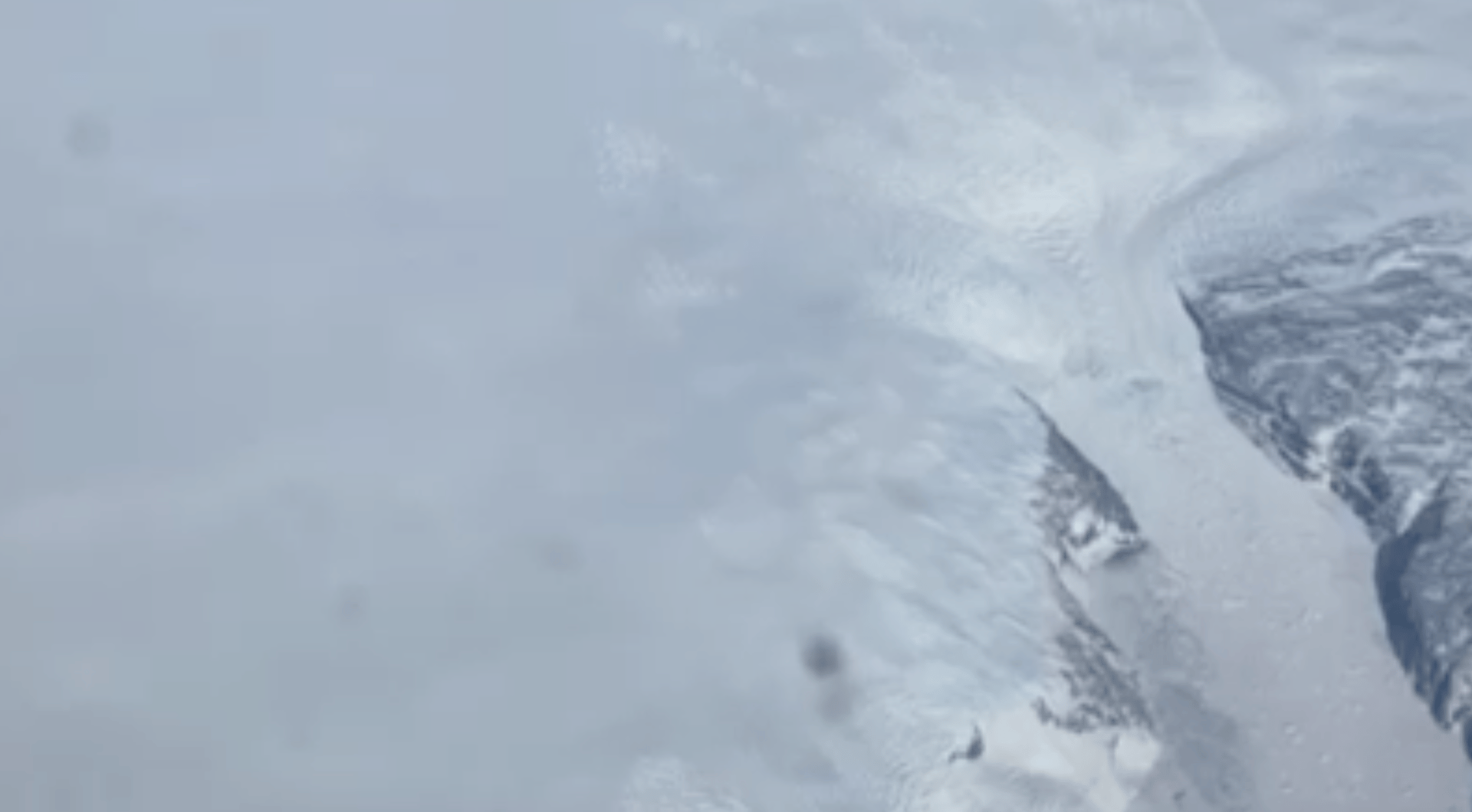
In the East Coast, the surrounding mountains and valleys in the fjord seem so reachable, but the closer you get to them, they tower abrubtly. The first image are mountains from above and second image are the mountains looking out from the Hangar. To fly over them or to follow the coastline amplifies the bird's optic array. You've seen how their wings are forced back if the winds are strong. They simply float in the air. As the birds get carried by the wind, going with the flow, there are frictional forces at play between the wind and terrain surfaces that slows down the wind. The more mountainous terrain, the more frictional effect. Depending on the altitude, the friction layer varies. As would be the case on top of the Inland Ice. The farther in on the Inland, the air in motion has nothing in it's way. The winds meet frictional forces closer to the coastline.
When there are pressure differences, the wind blows in attempt to equalise the pressure. When there is a high pressure in one area, along with the pressure differences, this creates pressure gradient fores (PGF). PGF moves the air from high to low, and as it moves across, winds can be strong or light.
Have you ever noticed the movement of clouds? There is the Coriolis force that acts on moving parcles of air and deflects the air to the right in the Northern Hemisphere and left in the Southern Hemisphere. This Coriolis effect is the right turning tendency in the atmosphere, turning the air current as it makes it way towards the Equator. The Coriolis force is most noticeable towards the Poles and least noticeable towards the Equator.
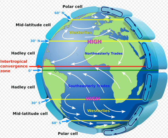
In a low level ciruclation pattern using the Coriolis effect, with convection, colder air descends down from the Pole (90° descending to 60°) but being turned due to the Coriolis, from the mid-latitude (30° rising to 60°), warmer air rises towards the Pole, again being turned; where the two pressures converge at the ridge 60° -creates a higher pressure belt. On top of Greenland, sits a high pressure system. See image above of Global Winds.
Recall the wind patterns in the three cells. The ingenuity of the atmoshere is in the three forces - PGF, frictional and Coriolis - affecting the flow of wind relative to the surfaces of the Earth. To recap, prevailing winds are winds moving from high to low pressure areas, modified by Coriolis force and terrain friction such as mountains, valleys, and coastal rocks.
To fully appreciate this is to know that the local wind patterns are caused by the same forces as the global winds patterns. Global wind patterns cause the earth’s overall weather, but localized wind patterns are much more important to pilots.
A few days after I arrive, DMI (Danish Meteorological Institute) forcasted a Pitterraaq, a East Greenland weather phenomenon: gale-like winds accelerating down from the Inland Ice. This was at the end of the month 31 May 2024. During this time with the pilot on duty, besides the settlement route flying, it was Charter season for picking up ski expeditions.
Five teams were moving down from the ice, one after another. The largest team from Norway was further behind. I receive a text message from the team consultant for the Norwegian team. His team was 120km west-northwest from Isortoq, the settlement nearest to the Inland Ice. Sent Friday 31st May, the message noted that his team was still on the ice. Below is part of the correspondence. The first message askes for the latest update on the storm coming Sunday/Monday, 2/3 June.
When I arrived in Tasiilaq the second time at the end of May early June, I reread a posting where I wrote impressions of what I saw the first time in April - the greyness of fog, the broken sea ice, the sound of ravens above and the silent bay. The same lies true the second time. I've heard of Glaciers acting (see Julie Cruikshank's book Do Glacier's Listen (2005). And I've heard of sea ice 'speaking to itself' (See Chapter 4 from Bethsheba Demuth book Floating Coast (2019). At that moment where I was standing by the hangar, I heard no sound. The ice was silent. So when the air is this still, what do we listen for? The calm before the storm? - as we have all heard.
Insulated by the steep mountains around, the air perhaps had reached it's equlibrium. Yet, air is continuously fluctuating in temperature. As air rises, it uses heat energy to expand. Take for instance when water absorbs heat, it evapourates, or when water releases heat, ice particles form. In the variation of heat transfer from a liquid like water or gas like air, this is known as convection. Moreover, going from high to low pressure, air constantly is changing. Air carries it’s weight, and the weight of being a poor thermal conductor. And the burden of circulating the entire earth. Air doesn't float around, it moves and when air vertically lifts, the moisture that was present reaches into the higher regions. In the Polar regions, the cold air that warms, starts to move towards the Equator. In between the Poles and Equator are three cells where air circulates in a global pattern. The Polar Cell, Ferrel/Mid-Latitude Cell, and Hadley Cell have a 30°difference in latitude. All three cells are found in both hemispheres. At each latitude where they meet, 0° to 30°(Hadley Cell), 30° to 60° (Ferrel Cell or Mid-Latitude Cell) and 60° to 90° (Polar Cell), are regions where colder air moves towards warmer regions then rises again or convects. In each cell, as air convects, the uplifting of air, causes the change in pressure and creates winds in the atmosphere.
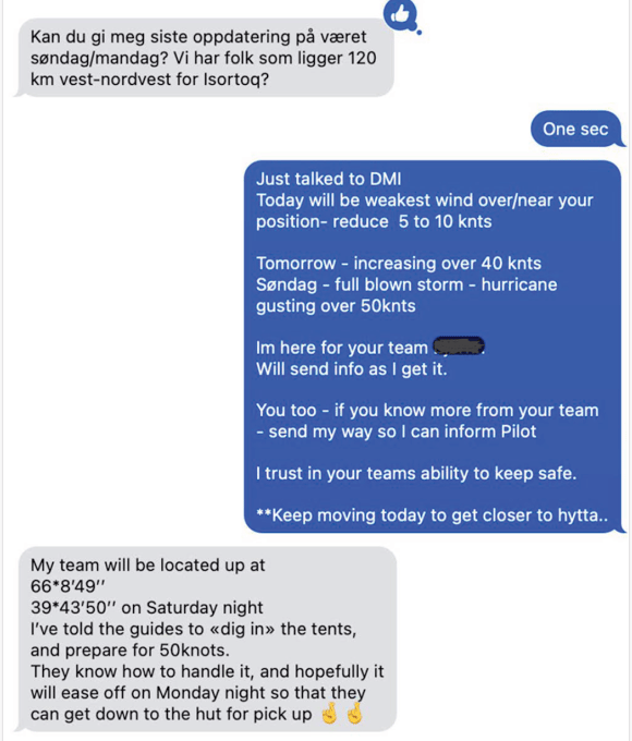
I call DMI, Danish Meteological Institute office in Nuuk, to get an update. I urge the team to keep moving before the Pitteraaq really gains greater strength on Sunday. He responds with assurance that they will 'dig in' their tents. On top on the ice, there is no barrier. Digging a hole is the best option. The good thing is, these Norwegians are hardy. The cold nothingness of Finnmark, in northern Norway and places like Hardangervidda can prepare most extreme sport enthusiasts for the ice-cap crossing. His team knows the current conditions best since they are in it.
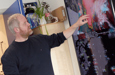
For a second opinion or confirmation, Pilots often call DMI. DMI are the ones who send the weather reports and forecasts. To undersand more about how the weather systems are in Greenland, I met with the DMI office in Nuuk before this second visit to the East Coast. Throughout this platform, DMI's valuable insight is added. Below, the Met person explains a rather complete 'Bigger Weather picture' of Greenland.
" Weather movements in Greenland is dominated by the low pressure systems and the high pressure systems. So usually, all the low pressure system is moving Southwest to Northeast. Some pressures systems move south of Greenland all the way up along the East Coast. But sometimes it moves along the coastline on the West. Especially in the southwestern part, it can be quite windy when there's a low pressure system. And also on the East Coast, due to the ice cap."
The bigger weather picture of Greenland is the pressure systems, frontal systems, and the Inland ice. The wind is quite important because the wind from the ice, it's usually drier and colder, which mainly makes it good weather conditions. And when we get the wind from the sea, it's moist. And so in the summer it could be low clouds or fog. And in the winter it will be snow showers. So, the wind is quite dominant.
When it comes to the bigger systems affecting Greenland like the low pressure, we get a better forecast. Even on the Inland Ice, we get good wind forecasts from our models. In the summer time, we make a two day forecast from the summit and for certain areas. We do get observations from the Inland. Most of the time, there's bad visibility on top. In general, with less observations and with less frequent reporting, it's quite difficult to make forecasts for the Inland Ice. In the winter time, we get one report each day. Sometimes the models forecast a lot of clouds when that was not the case, but the winds are well forecasted - in the bigger picture.
In the local fjord systems, it's really hard to forecast winds because it's different from one fjord to the other. The bigger the system, the better it's forecasted."
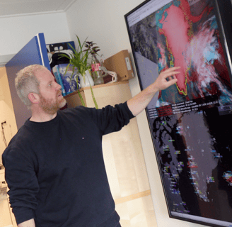
The image below is of the very helpful Met guy. The Met office is a great resource and don't mind getting Pilot feedback so they can adjust their models.
In the previous post, Before the Southeasterly Winds, this wind could move fog allowing the flight plan to resume. Along with causing the redistribution of weather, winds create weather by convection (lifting of air) as noted above. When winds are adverse such as the Pitteraaq, it's safe to say, all flights are cancelled. Below, Pilot AP details how a Pitteraaq forms.
"Before the strong winds of the Pitteraaq, sits a cold, high pressure on top of the ridge where the inland ice meets the sea about 50km from the coast. It's heavy cold air. The cold air falls through the warmer air. On top of the steep ice sheet is a piercing cold north-northwesterly wind speeding down from the Inland Ice. Any pilot who has been on the East Coast before has heard of the Pitteraaq weather phenomenon. They know of the low-pressure approaching Greenland from the East. They are aware that there are hardly any signs of clouds forming to foresee oncoming weather. As Pilot AP would tell me, “I know that the wind starts from the top of the ice sheet, and as this katabatic wind descends, it intensifies. And when that cold, dry air from the ice sheet meets the low pressure from the coast, the pressure gradient tightens, the wind accelerates. Between the coastal valleys, the wind velocity increases dramatically.” Pilot AP has over 20 years of experience flying various helicopters in Greenland. Although pilots are well aware of the potential of the Pitteraaq to reach hurricane speeds of 155 knots gusts average speed of 77 knots; they also know how difficult it is to predict the intensity of the wind speed. Those skiers 120 km on top, they would feel the wind's magnitude.
On that Friday, as the winds blow, and kept escalating, we all wait knowing the high pressure would eventually move towards the low pressure. In this fjord system, the Pitteraaq’s dominant effect is along the coast and valleys in the direct line of Isortoq and Tasiilaq, but just 12 nautical miles to the East, in the neighboring fjord, Kulusuk will barely feel the winds.
The apprehension is that these winds accelerate as they descend. From the steep drop of the Inland Ice to the open water, the Pitteraaq passes through the surrounding mountains and the lower valleys inbetween. The other part of the apprehension is that Pilots also know the Pitteraaq begins to weaken as it spreads over the sea.
Update: before the Pitteraaq's full force expected on Sunday/Monday, the four teams descended safely and were picked up on 1 June by Greenland Copter, the East Coast Charter company, see image above. 4 June, the Norwegian team further in on the Inland noted above was picked up by Air Greenland. The winds died down and the helicopter was able to land safely and takeoff, bringing the team to Tasiilaq.
East Coast operations are quite special, having the Inland Ice in the vicinity. Ski expeditions crossing the Ice Cap from West to East with their pulks, skis, and remaining food start to descend from the Inland Ice, where there is a natural slope reaching the coastal rocks. The pickup point or the Grill Hut/Hytta is an area that is usually flat and hardened. The surface at this pickup point is familiar to pilots, having had experience picking up skiers here before, and although familiar, the hytta's and any surface near or on the Inland Ice is highly dependent on the season, winds, snow surface, percipitation (snow), visibility (fog), light conditions, cloud cover, Sun's position and time of day.
Below are two images, one of the Grill Hut/Hytta and the other is a closeup of helicopter on an area that looks pretty solid.

I met up with Pilot RP who recently arrived in the Tasiilaq area after some time being away from the East Coast. A pilot's life is to rotate around the six operating bases all over Greenland. Talking with the Pilot, who has been flying for over 15 years in Greenland, he recounted one pickup. "Yesterday was my first terrain landing on the Ice Cap in the helicopter. And a live mission (not in a simulated situation). I've been doing a few landings for training. But this was my first hot one where I had to find a position. Recon the position and then actually do the landing with wheels. It turned out to be really good. A good spot. Hard ice level, so no problem at all. But when landing on a surface that is sloping or softer, I would definitely be more cautious on this machine compared to the other machine where I have a lot more experience flying in. And here (Inland Ice) there is also with the possibility of a whiteout on landing."
When strong winds keep the snow suspended up to about 50ft or so, obscurring the sky, and reducing the surface visibility to near zero, this is what is known as a whiteout. When landing, snow is lifted from the surface from the downwash of deflected air from the rotor blades, and blown in such amounts that the horizontal visibility is considerably reduced. Light, dry powder snow is most prone to being blown around by wind or machine.
Low and High Reconnaisance
When preparing to do any pick up on the Inland Ice, whether pick up point at the usual Grill Hut/Hytta or not, gather as much information as possible about the whole surroundings.
High Reconnaisance
During high reconnaissance, the altitude is around 300 to 500 feet above the surface. Pilots have a 45° angle of observation, studying the area at the same time so as not to fly into something. In Greenland, the surface features of the environment in a high reconnaissance have more to do with the wind and light conditions. Keeping in mind, obstructions are the height of barriers near settlements, the presence of obstacles around mountains such as telecommunication masts, the relative size of confined areas, and the slope of the terrain. However, as the pilots informed, more often, a low reconnaissance gives more information of the surface.
Preparing to do a low reconnaissance on the Inland Ice happens during an approach to the landing site. Before this, like Pilot RP, do a high recon coming in. If possible, a call is made out to the skiers assessing the surface and how the pick will be done according to the pilot. During the low recon, having an eye out for a hard surface is ideal. For Pilot RP, the spot was solid. At any point, the Pilot could choose to abort the approach, however, part of being a pilot is a 'Get the Job Done' mentality that also relates to the helicopter they have the most experience with. Doing the recon and finding a hard landing spot is only part of the desirable outcome. Pilot RP's decision to go low depends entirely on that day's surrounding light conditions, winds, and Sun's position.
Before the low reconnaissance, minutes before, with the skiers in sight, Pilot HP, recounted a time he did a Charter pick up. He recounted his high and low reconnaissance:
"Coming in, I start to scan to see where the wind is coming from. On this location, there is nothing but white snow and ice. So if there is wind, there will be snow fans. IF there are no winds, once in sight of the skiers, I look for equipment that might be blowing, like a tent or other. I look at the skiers too to see if they sunk into the snow. So, I came around. Coming in low, I can determine a flat area. But it's less visible when the conditions have a flat light. The sun casts a shadow and when there is no sun, there are no contours, instead you see a flat light. A flat light, sometimes called a white light or white out is when the light that comes from the sun behind the clouds spreads over the surfaces and contours are visible. But when there is no shadow cast to indicate an angle or height, the light is flat, the surface height is indistinguishable. Coming in not too high or too low, making sure I had enough altitude just in case something goes wrong with the machine, seeing through the surrounding light, I was looking for a hard surface.
He continues:
The current machine has wheels and a good thing to do is look for a place that is hard enough not to sink in."
Low Reconnaissance
Light conditions on the Inland are assessed at that moment. Recall Gibson's point of observation that in movement, information to be percieved comes out and into sight. When flying to an unknown area, case in point, the Inland Ice, the visibility can be a single light colour. A light that makes the surface visible comes in sight only when there is a shadow to cast, as noted above. Most noticeable in the Spring and Autumn, when the Sun is near the horizon creating gradations in light. This flat light occurs when a layer of overcast clouds overlies a snow surface or ice-covered surface, parallel rays of Sun are broken up and diffused when passing through the cloud layer so that the rays strike the snow surface from many angles. This diffused (flat) light then reflects back and forth between the snow covered surface and the cloud, eliminating all shadows. The result is a loss of seeing how high or low from the pilot's point of observation viewed from the helicopter in the air of the surface height, the 'coming out of sight' flying from above.
When looking for a hard surface when light conditions offer little 'background' to distinguish in light patterns, the information for the pilots to 'pickup' from the optical array occurs when the moving background 'comes into sight.' Relating to Gibson's continous background surface, it is when pilots commit to the landing, for going 'out of sight' then becomes 'into sight,' that the environmnet affords pilots who has seen or encountered such a diffused light before. As Pilot HP informed, "It is in the low reconn that the surface is visible and hopefully, when doing the high reconn, a reference point like skiier's equipment like a pulk or rucksack (similar to an orange cone) can offer a surface height if the light conditions take away any layers on the surface." In this regard, what pilot's are able to 'pick up' in information becomes an affordance.
It's not very often pilots fly when the visibility restrictions are lmiiting, especially if the snow conditions create a whiteout or if there is no reference point to land or lack of contrast. In other words, if there is no visible way to gauge the distance between the landing gear and the surface - do not land. Above all, Pilots do not want to hover over any surface in an area that could create blowing snow. So when pilots do commit to a landing on the Inland Ice, some pilots use a reference point for landing. As I've heard from all the pilots, assessing the surface conditions in a high and low reconnaissance to land on the Inland lce comes minutes before, then seconds before, and up to the very moment they commit (to the landing).
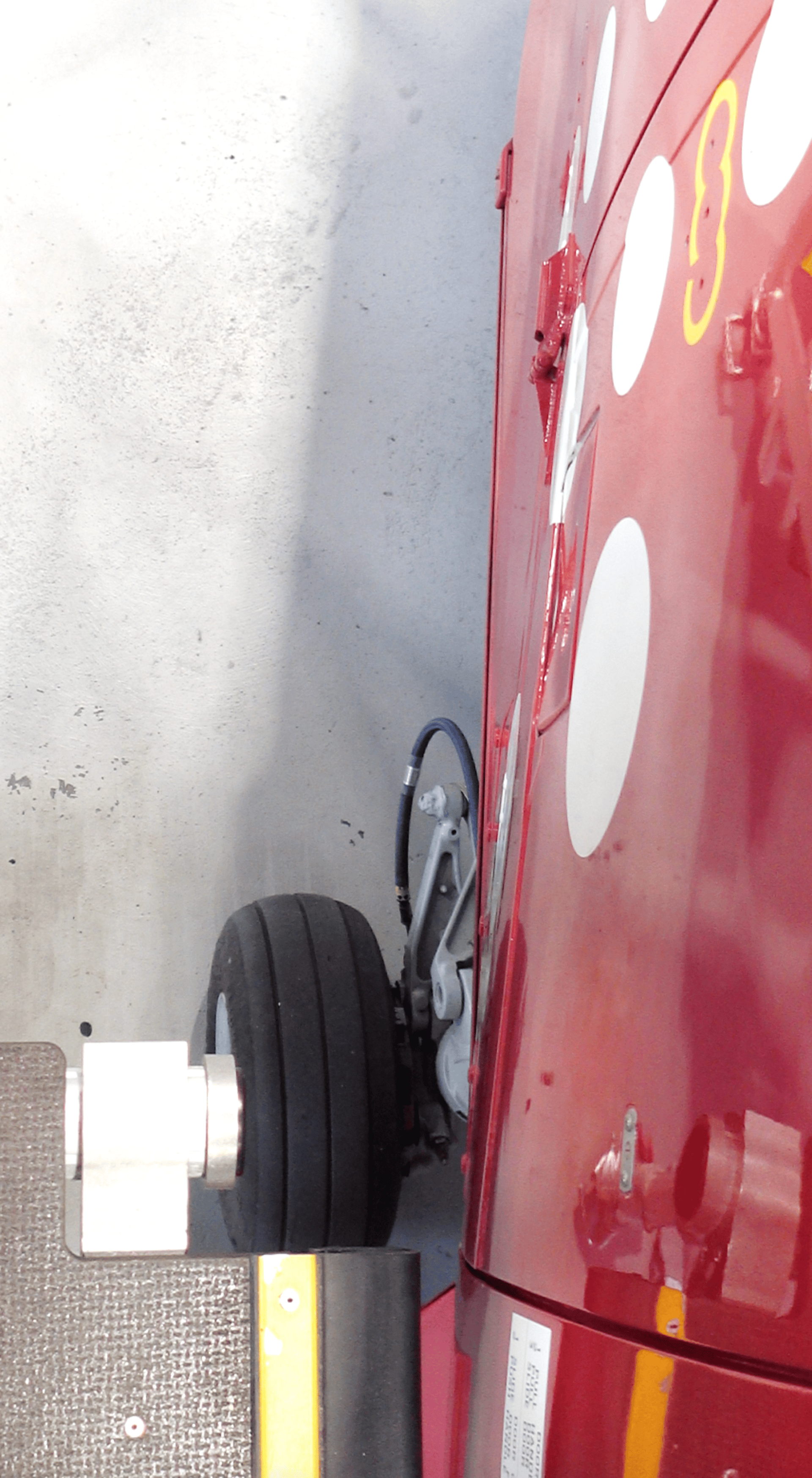
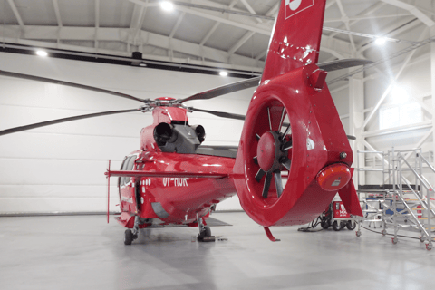
Mechanics have a rather astute knowledge on the mechanics and redundancies built into modern helicopters, such as in this Airbus helicopter. They survey the helicopter detailing technical elements. In general, according to the mechanic on duty:
"There is a potential for issues when landing on a surface that can damage equipment that lies under the belly of the helicopter, such as the antennas for radio and navigation equipment and hydraulic lines. We haven't seen that happen yet. I haven't seen so many issues. In these Arctic temperatures, the heated hangar is essential."
He adds,
"Of course we see some failures once in a while, but in general, we have not had many issues. We are working with Airbus on issues we encounter. Most important our aircraft are parked inside in a warm hangar. We pull the heli out, we start them up and fly within 20 minutes. And during the day, well, we can easily start up an aircraft to keep it warm if that's the problem."
Below is the helicopter in the warm hangar.